DJI’s New Geofencing Policy: What It Means for Everyday Drone Pilots
Keith Lusher 01.23.25

In what might go down as one of the most puzzling cases of corporate timing, DJI chose January 13th to remove its geofencing restrictions—mere days after one of their drones collided with a firefighting aircraft battling blazes in Los Angeles. As someone who’s spent years flying drones, I had to read the announcement twice to make sure I wasn’t missing something.
Here was DJI, the world’s leading drone manufacturer, effectively removing the very safety feature designed to prevent exactly this type of incident. The company insists this change has been in the works for months, but the timing certainly raised eyebrows across the drone community, including mine.

So what’s the big deal? So DJI has fundamentally changed how its drones interact with restricted airspace in the United States. What does this mean for the average drone enthusiast? Let’s break it down in plain terms.
The Big Change
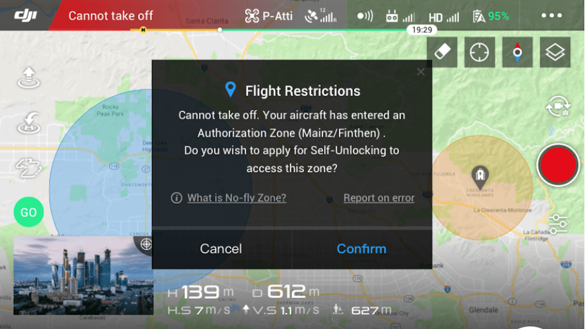
Previously, if you tried to fly your DJI drone near an airport, military base, or other restricted areas, the drone’s software would simply prevent you from taking off or flying into these zones. Now, instead of acting as a digital fence, your DJI drone will simply warn you about restricted areas and leave the decision-making to you.

What Hasn’t Changed
While DJI’s software may have become more lenient, the Federal rules governing drone flight remain firmly in place. The removal of automatic restrictions hasn’t changed the legal landscape one bit – you still need proper FAA authorization to operate in controlled airspace, and the regulations prohibiting flights near airports, military installations, or over the White House are as strict as ever.
Emergency restrictions, such as temporary flight restrictions during wildfires, continue to carry the full weight of the law. The only difference now is that the responsibility for following these regulations rests entirely on the pilot’s shoulders, rather than being enforced by the drone’s software.
New Safety Features
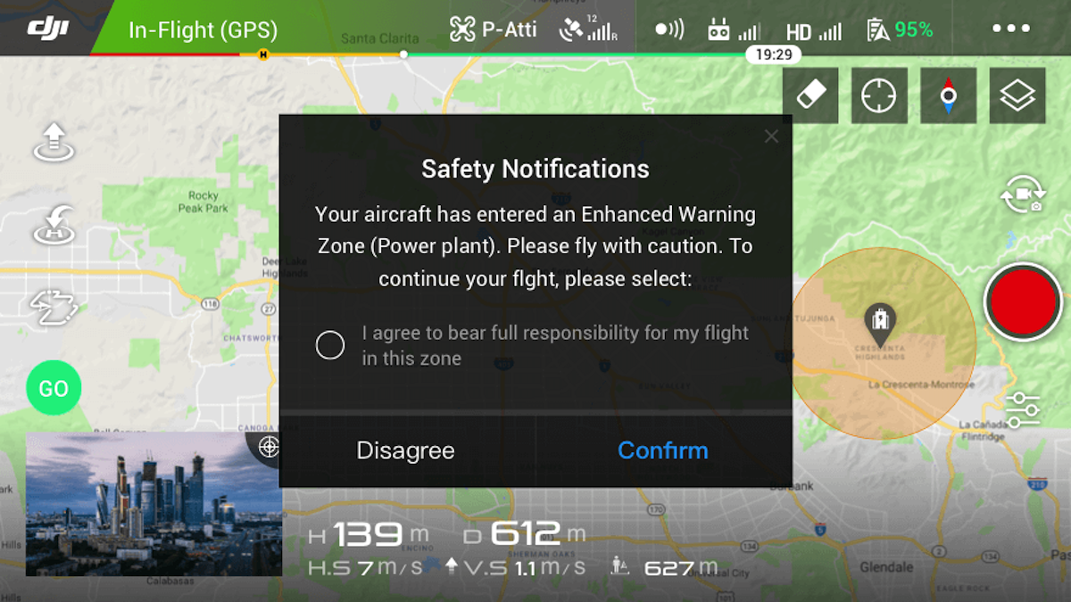
The latest updates to DJI’s flight software bring significant changes to how pilots interact with airspace information. The DJI Fly and DJI Pilot apps now feature a redesigned interface that replaces the previous Restricted and No-Fly Zones with what DJI calls Enhanced Warning Zones. These zones are now based directly on official FAA airspace data, providing pilots with more accurate and up-to-date information about flight restrictions.
When approaching these areas, the apps display clear alerts to ensure pilots are aware of potential restrictions, though the final decision to proceed now rests with the operator. This falls in line with their claims that they are, “placing control back in the hands of the drone operators.”

Bottom Line for Average Users
For the everyday drone pilot who consistently follows the rules, this change might seem more dramatic than it actually is in practice. However, it does place a greater burden of responsibility on your shoulders as a pilot.
You’ll need to be more vigilant than ever about understanding and following airspace restrictions in your flying area. This means thoroughly researching where you can legally operate, securing proper authorizations when required, and staying current on temporary flight restrictions that might affect your flight plans.
The key takeaway here is simple but crucial: your drone’s newfound ability to physically enter restricted airspace doesn’t equate to permission to fly there. The consequences of violating airspace regulations remain severe, and with the FAA’s new Remote ID requirements now in effect, it’s easier than ever for authorities to identify pilots who break the rules. Consider this change not as a removal of restrictions, but as a transfer of responsibility from your drone’s software directly to you as the pilot in command.

