Humminbird Introduces AutoChart Mapping Products
OutdoorHub 05.27.14

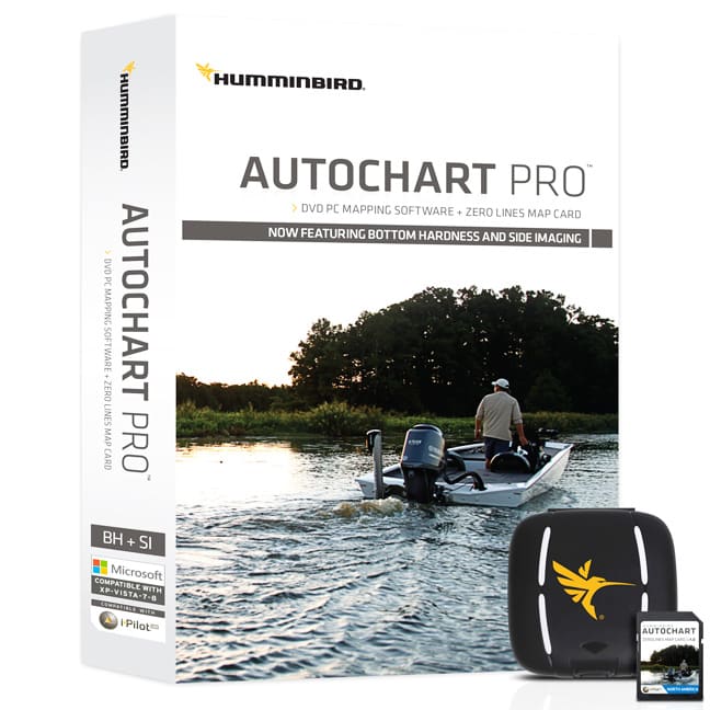
Just in time for summer fishing opportunities, anglers now have the ability to chart private, public and hard-to-reach waters far off the radar of government surveys and commercially-available paper maps and digital GPS charts. That means you can finally map your own favorite lakes, reservoirs, rivers, ponds, as well as offshore locations. Now available at retailers worldwide, the revolutionary angler-built mapping technology comprises PC mapping software on DVD and a Zero Lines Map Card designed for use in Humminbird units only.
AutoChart: Map coverage where you make it.
Available for a one-time purchase price, no subscription or pay-by-the-lake fees, Humminbird AutoChart and AutoChart PRO put the power in anglers’ hands, not the company behind the product (or fellow anglers).
There’s no uploading to a server or Cloud. AutoChart does it instantly – and your data is kept private, so your competition is none the wiser.
Maps are created on your own computer from the data collected on the SD card from your Humminbird unit in three simple steps:
Step 1: RECORD: Insert the AutoChart Zero Lines Map Card v.1.0 card into your Humminbird unit card slot and record your lake data by activating the Track Log or Sonar Recording feature in your Humminbird unit. If you connect your Humminbird unit to a PC, AutoChart will also create and display maps in real time. At the end of the survey, simply save and export the data to your card.
Step 2: CONVERT: Insert the AutoChart SD card into you PC, import data and click the Create Map toolbar button. To display your map in high-definition depth contours, then click LakeMaster Update button.
Step 3: EXPORT: Remove card from PC and load onto your Humminbird unit to display your custom map!
ZERO LINES MAP CARD
The Zero Line is the place where the water meets the shore. The AutoChart Zero Lines Map Card contains Zero Lines for millions of waters across the globe, which serve as the basis for each custom map creation. Choose from North America, South America, Europe, Australia, Asia or Africa SD cards for your region of the world. With these all-important Zero Lines as your foundation, you can begin creating your own accurate and detailed maps of any fishing spot.
The Zero Lines Map Card is also formatted to record your sonar logs. After recording, load the card into your computer to let the AutoChart PC Software convert the recordings into a map that can be displayed on your compatible Humminbird.
DVD PC SOFTWARE
The AutoChart DVD software for your PC is the powerful engine used to turn survey data into a sophisticated lake map. The map created by the AutoChart software can be viewed on the computer AND be exported back to the Zero Lines Map Card to be viewed on you compatible Humminbird unit. Now you can have your own map for that secret fish-holding location and keep it a secret.
When viewing your AutoChart maps on your PC you will be able to see the underwater world in revolutionary 3D detail to give you a better understanding of what the structure looks like on your favorite lakes.
GOING PRO
Add another layer of detail to your AutoChart cartography. New AutoChart PRO offers all the leading features of AutoChart – but with two key enhancements designed to give tournament anglers a competitive edge. Bottom Hardness Indication identifies hard and soft bottom areas in rich, easy-to-read colors, revealing transitions in substrate density – often those hard-to-find, key fish-holding locations. For those running Side Imaging capable Humminbird units, Side Imaging Mosaic allows you to overlay your Side Imaging returns onto your AutoChart map for a 3D visualization of that habitat. With AutoChart PRO, you’ll have all the tools necessary to dissect waters – and find fish – like never before.
Also, for anglers surveying “spot on the spot” locations that may already be mapped, AutoChart products allow you to place custom map data with customizable transparency over existing Humminbird LakeMaster charts for an unprecedented level of detail.
Then, once finished creating your own custom map you’ll get use of LakeMaster’s three key patented features of Shallow Water Highlight, Depth Highlight and Water Level Offset on your map. Combine your map with Minn Kota iPilot Link and you can set your trolling motor to follow your custom contours! You can also offset these contour lines by any value you choose and automatically follow with your boat.

